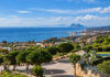
The Junta de Andalucía has just taken a strategic step that allows a huge property development in the municipality of Manilva to be simplified, involving the possible construction of around 4,600 homes and major sports facilities.
This follows the issuing by the Regional Sustainability Delegation of the strategic environmental report on the amendment to Manilva’s PGOU (General Urban Development Plan) affecting sectors SUS CDU‑1 “Manilva New Golf” and SUS CDU‑5 “Pedraza”, two large areas classified as “Residential Sports” in the municipal planning.
The ruling, dated 17 February, concludes that the modification will have no significant effects on the environment provided that an extensive set of conditions on water, habitats, noise, light, waste and cultural heritage is met.
The planning amendment maintains the land classification and the basic urban planning parameters set by the PGOU, including a maximum gross buildability of 0.33 and a density of up to 10 homes per hectare over an area of approximately 1,638,640 square metres.
The key change is that the overall Residential Sports use will no longer be exclusively tied to the mandatory golf course, and will be opened up to other alternative private sports uses considered to have a lower environmental impact.
As the report recalls, Manilva’s PGOU defined this overall use in 1994, linking the land to the reservation of 30% of the area for a golf course, a model that is now being partially revised for these two sectors.
Both «Manilva New Golf» and “Pedraza” already have detailed planning and approved urbanisation and management projects, unlike the third sector with the same use, OCU‑1 “Llanos del Tábano”, which has not begun the approval process.
Activation of the process
The Town Hall requested in October 2024 the start of the simplified strategic environmental assessment of the PGOU amendment in these sectors, accompanied by an urban planning draft and a strategic environmental document.
After admitting the procedure for processing in November 2024 and obtaining reports from various sectoral bodies, the Regional Delegation has issued the strategic environmental report dated 17 February 2026.
One of the most significant sets of conditions concerns water management and flood risk. The area lies within the Andalusian Mediterranean Basins district and is crossed or bordered by several watercourses, including the Sierra and Indiano streams and several tributaries.
In the public water domain and its easement zone, it is required to guarantee the ecological continuity of the channels, to prohibit buildings and roads in the easement zone, and to limit any development in that strip to public pedestrian and conservation uses.
The report requires detailed hydrological and hydraulic studies to be drawn up identifying flood-prone areas with return periods of 10, 100 and 500 years, defining the preferential flow zone and presented on plans at a scale of 1:1,000 with cross-sections every 50 metres.
The detailed planning that is approved must be compatible with the regulation of uses in flood-prone areas set out in the Public Water Domain Regulations, and this land may be allocated, for example, to public green areas with restrictions.
To reduce pressure on groundwater bodies, the amendment must minimise soil sealing and set minimum percentages of permeable surface on pavements, boulevards, squares and green areas, in order to promote aquifer recharge.
The Town Hall must also request the report on water matters from the competent Water Authority, including expected consumption, availability of resources and the suitability of the infrastructure of the integrated water cycle.
Habitats
Another of the central aspects of the opinion concerns the protection of the natural environment. Within the area of the amendment there are various habitats of Community interest, some of them priority habitats, such as neutral-basophilic Mediterranean grasslands, thermophilous scrub, oak woodland pastures, willow groves and oleander thickets, as well as wild olive groves.
The Junta requires the deterioration and fragmentation of these habitats to be avoided, the greatest possible extent to be conserved and any areas that may be affected by the urban planning to be compensated for on land with similar ecological characteristics.
As for fauna, the databases consulted for the area and its surroundings record the potential presence of species such as the common chameleon, otter, Spanish pond turtle and various birds of prey, including griffon vulture, lesser kestrel and Bonelli’s eagle.
The environmental document also sets out specific territorial conditions. Within the area there are several archaeological sites, including “Torre Abad 1”, “Torre Abad 2” and “Camino de Pedraza”, as well as part of “Camino de la Vizcarronda”, which means the area must undergo a surface archaeological survey before detailed developments are approved.
At these sites, diagnostic test pits will be required and archaeological monitoring of all earthworks must be established, and the Culture Delegation must be informed of any chance finds.
The report also identifies the presence of the Vereda de San Roque livestock route, around 20 metres wide and already classified and partly demarcated, which may not be occupied by the development, except for occasional crossings by roads or services subject to a favourable report.
With regard to transport infrastructure, the concession holder of the autopista del Sol raises no environmental objections, although the Town Hall must obtain the sectoral report from the State Roads Demarcation on the planning.